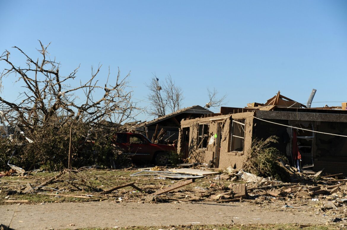
BURNET COUNTY, Texas — On May 1, 2025, a confirmed EF-1 tornado touched down in northeast Burnet County, causing widespread structural damage and injuring one person. The National Weather Service (NWS) issued a tornado warning at 4:13 p.m. CDT as the storm system moved rapidly south from Lampasas and Coryell counties toward the Austin metro area.
The tornado was first observed on the ground near County Road 223 around 4:20 p.m., carving a destructive path through rural areas of the county. It remained on the ground for several minutes, with estimated peak winds reaching 110 miles per hour. According to the NWS damage assessment, the tornado traveled approximately 3.22 miles and reached a maximum width of 880 yards, making it one of the wider tornadoes recorded in Central Texas in recent years.
One home was completely destroyed, and a large outbuilding was leveled. Another residence sustained moderate damage. A driver traveling on County Road 223 was injured when the tornado overturned his vehicle. The individual was transported to a local hospital with non-life-threatening injuries and is expected to recover.
In addition to the tornado threat, the storm system brought damaging hail and high winds. Golf ball-sized hail was reported across Burnet and Williamson counties, and a severe thunderstorm warning was issued for Burnet and Bertram between 5 p.m. and 5:45 p.m. The warning impacted more than 17,000 residents, with forecasts predicting winds up to 60 mph and large hail capable of damaging roofs, windows, and vehicles.
Emergency response crews were deployed quickly across the affected areas to assess the damage and clear debris from roads. Local fire departments and public works teams worked into the night to restore access to isolated areas and assist residents with immediate recovery needs. The Burnet County Office of Emergency Management urged citizens to use the Texas Division of Emergency Management’s iSTAT damage survey tool to report storm-related destruction.
County Judge James Oakley thanked first responders and emphasized the importance of preparedness: “This was a fast-moving and dangerous storm, and we’re grateful there were no fatalities. We urge everyone to continue monitoring weather updates and to have a plan in place during severe weather season.”
Meteorologists say the May 1 event is part of a larger pattern of severe spring weather across Central and North Texas. It follows a series of recent storms that have brought flooding and hail to other parts of the state. Atmospheric conditions, including a collision of moist Gulf air and an upper-level low pressure system, contributed to the formation of supercell thunderstorms capable of producing tornadoes.
The storm also serves as a reminder of the unpredictable nature of severe weather in Central Texas, a region that often straddles the southern edge of “Tornado Alley.” The NWS continues to advise residents to remain vigilant as additional rounds of thunderstorms are possible in the coming days.
While power outages were limited in Burnet County, utility providers remained on alert to address any storm-related disruptions. Schools in the area resumed classes with additional safety protocols and emergency preparedness drills scheduled in the aftermath of the storm.
As the community begins recovery efforts, officials remind residents to beware of downed power lines and to document property damage for insurance purposes. Several nonprofit organizations have also mobilized to provide emergency supplies and temporary shelter for those displaced.

