
Texas Prepares For Major Flood Threat As Hurricane Polo Sends Tropical Moisture North

Texas mobilized emergency resources September 28 as Hurricane Polo’s moisture raised the risk of heavy rain and flash flooding statewide.
For Texans watching another hot September afternoon unfold, the most important weather story was developing hundreds of miles away. On September 28, state emergency officials increased preparations for a potentially significant stretch of heavy rainfall and flooding as deep tropical moisture associated with Hurricane Polo began influencing weather across the Southwest. The Texas flood threat was expected to grow through the week, placing communities from West Texas to the Interstate 35 corridor on alert.
Texas Flood Threat Prompts Statewide Preparations
Texas officials announced September 28 that additional emergency response resources were being activated ahead of the expected rainfall. The Texas Division of Emergency Management was directed to increase readiness as forecasts showed the potential for heavy rain across large portions of the state over several days.
The preparation reflected concern that repeated rounds of rain could create dangerous conditions even in places that do not receive the highest overall totals.
The unusual setup was being fueled partly by tropical moisture connected to Hurricane Polo. The hurricane struck Mexico’s Baja California Sur region and was expected to weaken as it moved inland. However, the system’s moisture was forecast to continue north into the United States, increasing the amount of water available to developing storms across the Southwest and Southern Plains.
That distinction matters. Texas was not facing a direct hurricane landfall from Polo. Instead, tropical moisture from the system was interacting with a broader weather pattern capable of producing repeated heavy rainfall. This type of setup can create flooding well away from the original tropical cyclone.
Why The Weather Pattern Matters For Texas
Forecasts issued September 28 indicated that the threat would develop over several days rather than arrive as one brief storm. Central Texas was among the areas drawing particular attention, while East Texas forecasters also warned that heavy rainfall could become a concern later in the week.
Meteorologists in East Texas reported that Thursday and Friday were designated First Alert Weather Days, with forecasts calling for two to three inches or more of rain in some locations and the possibility of flooding.
Meanwhile, forecasts for Central Texas indicated that the Interstate 35 corridor and surrounding communities could experience multiple rounds of rainfall. The potential for storms to repeatedly move across the same areas was an important concern because soil can become increasingly saturated as rainfall accumulates.
Weather forecasts on September 28 also indicated that moisture associated with Polo could contribute to a broader flood threat extending across parts of New Mexico, Colorado, Texas, and Kansas. Some areas of the Southwest and central United States could receive several inches of rain during the prolonged event.
For Texas residents, the timing was especially important. The highest flood risk was not necessarily expected on September 28 itself. Instead, Monday’s preparations represented an early response to forecasts showing conditions becoming more favorable for heavy rainfall as the week progressed.
Flash Flooding Remains The Central Concern
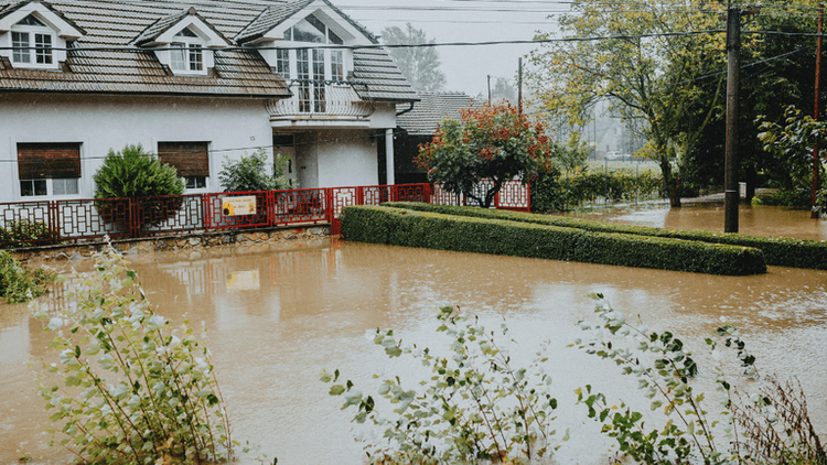
Flash flooding can develop rapidly when intense rainfall overwhelms roads, drainage systems, creeks, and low lying areas. That makes rainfall intensity as important as the total amount recorded over several days.
Texas communities have extensive experience with this danger. Roads that appear passable can become hazardous quickly when water rises, particularly around low water crossings. The developing forecast therefore gave residents time to monitor local conditions before the most significant rainfall arrived.
The September 28 response also demonstrated why tropical systems can remain consequential after weakening or moving far from the coast. A hurricane does not need to make landfall in Texas to influence the state’s weather. Moisture transported north can interact with fronts and other atmospheric disturbances, creating significant rainfall far from the storm’s original path.
What Texans Should Watch Next
The key takeaway from September 28 was preparation rather than panic. Forecast details can change as weather systems move, and rainfall totals can vary substantially from one community to another. Residents should monitor forecasts from the National Weather Service and local emergency management agencies for updated watches, warnings, and rainfall projections.
For TexasRecap readers, the developing Texas flood threat is a reminder that the effects of tropical weather can extend far beyond the coastline. September 28 marked an important preparation point as state resources moved into position and forecasters refined where the heaviest rain could fall.
With several days of unsettled weather expected, Texans can benefit most by following official forecasts, checking conditions before traveling, and treating flood warnings seriously. The storm’s exact impacts will depend on where the heaviest rainfall develops, making reliable local updates particularly important as the system moves across the region.

Texas Recap Contributor
Covers the local desk — breaking news, community reporting, and sport across Texas.
This article features partner, contributor, or branded content from a third party. Members of the Texas Recap editorial staff were not involved in the creation of this content. All views and opinions are those of the contributor alone.
You May Also Like

E. Coli Outbreak Linked To Raw Milk Cheese Raises New Food Safety Concerns Across The U.S.

Nelly Opitz and the Limits of Being Seen
Heavy Rain Triggers Flooding Across Parts Of West Central Texas

Texas Government Services Put Digital Access And Public Information In Focus

Dak Prescott Makes Dallas Cowboys History In 37 To 20 Victory Over Washington